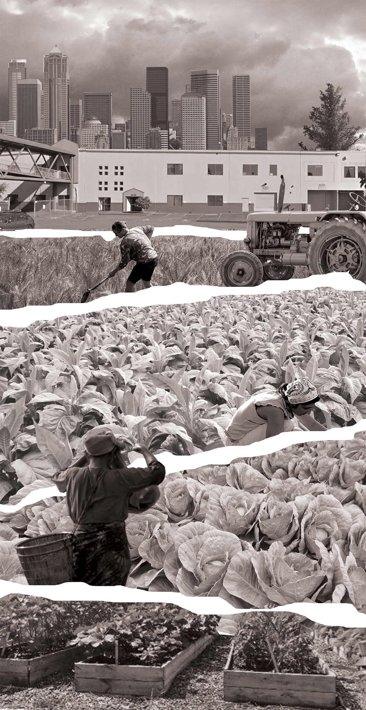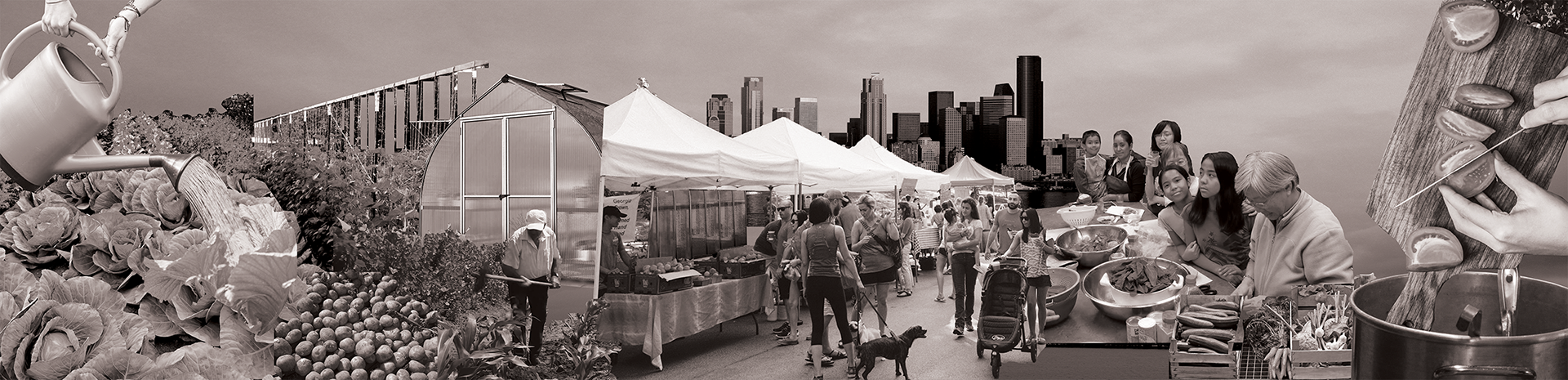
What if the act of growing, trading, and sharing food was used as a way to strengthen neighborhood resilience - both against gentrification and against the imminent thread of an earthquake?

Demographic analysis of three census tracts within the Mt. Baker neighborhood.
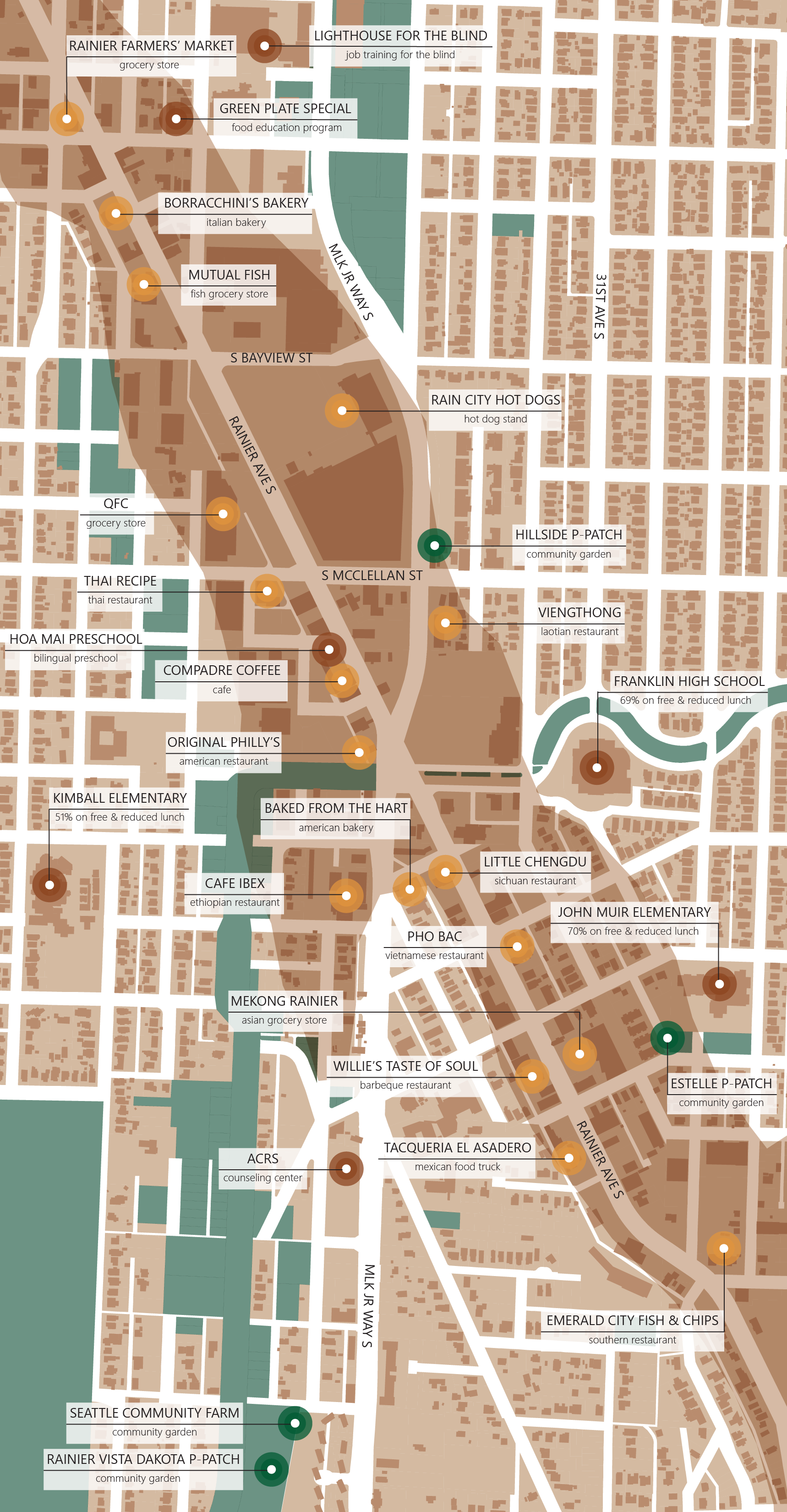
Documenting existing spaces in Mt. Baker to grow (green), trade (yellow) and share (red) food.
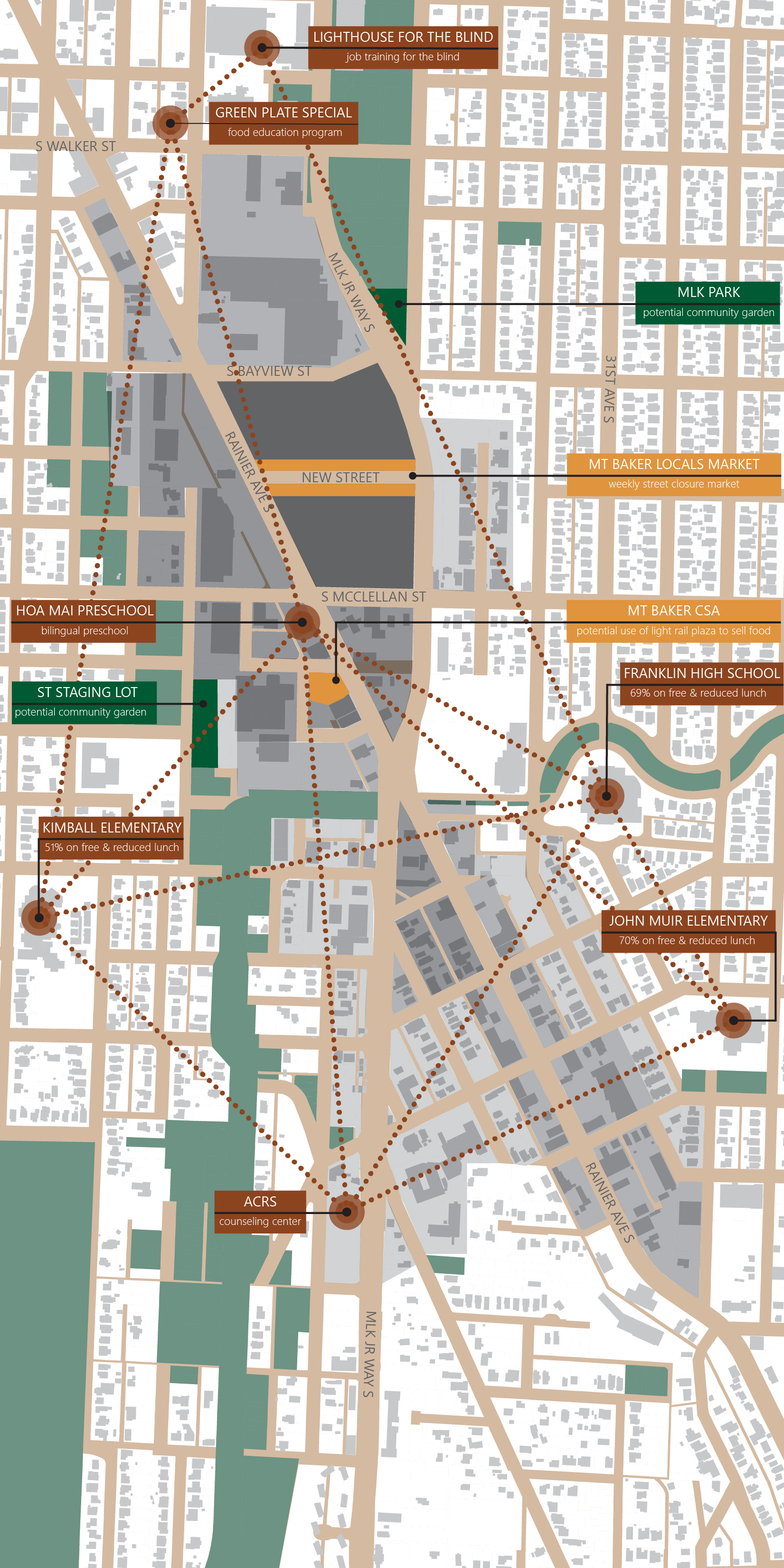
Identifying areas of opportunity to grow, trade, and share food in the future, as part of a neighborhood earthquake resilience plan.
(Left) Documenting existing spaces in Mt. Baker to grow (green), trade (yellow) and share (red) food. Extent of liquefaction-prone soils shown in dark brown. (Right) Identifying areas of opportunity to grow, trade, and share food in the future, as part of a neighborhood earthquake resilience plan. Different height limits for new construction (in gray) are applied to different blocks.
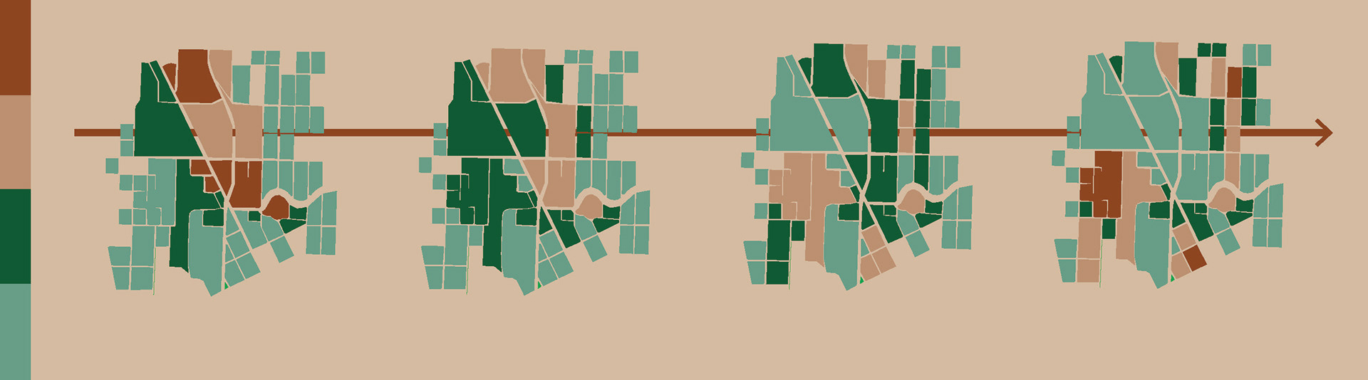
Proposal overview to introduce urban agriculture uses at the same time as developing new housing in order to shift the density of the neighborhood away from existing liquefaction-prone soils. Dense areas (red) gradually give way to less-intensive use (green).
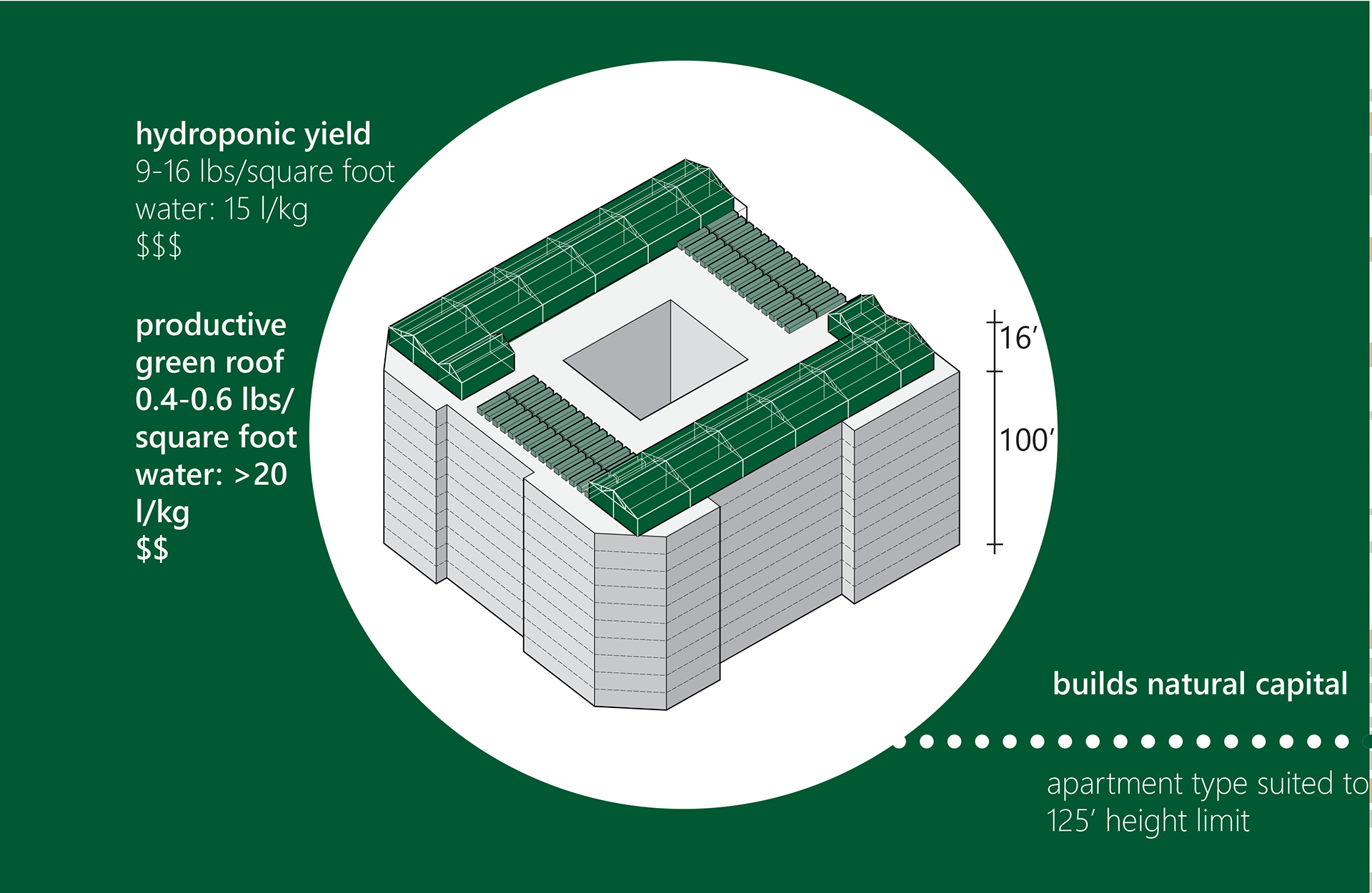
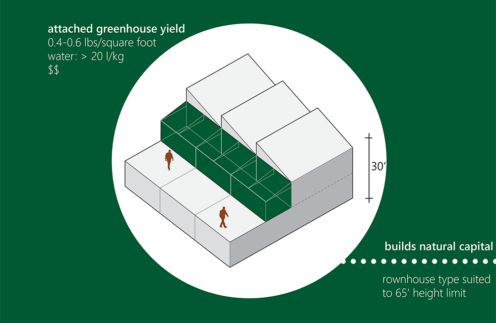
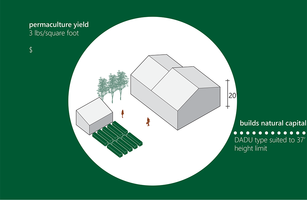
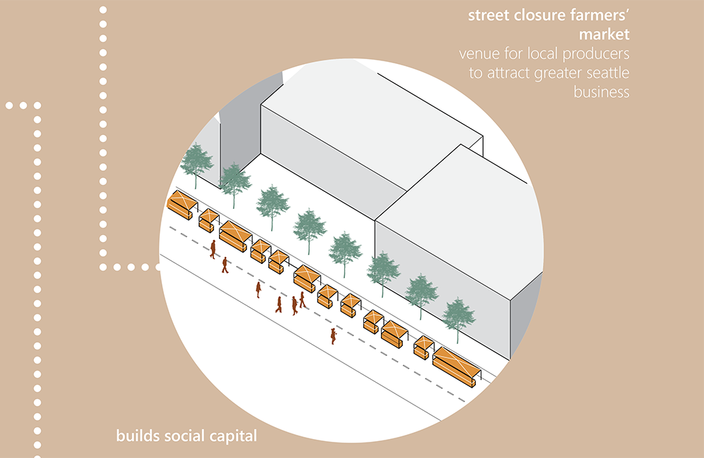
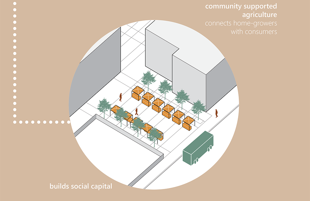
Pairing urban agriculture typologies with housing typologies + proposing new spaces to trade locally-grown food.