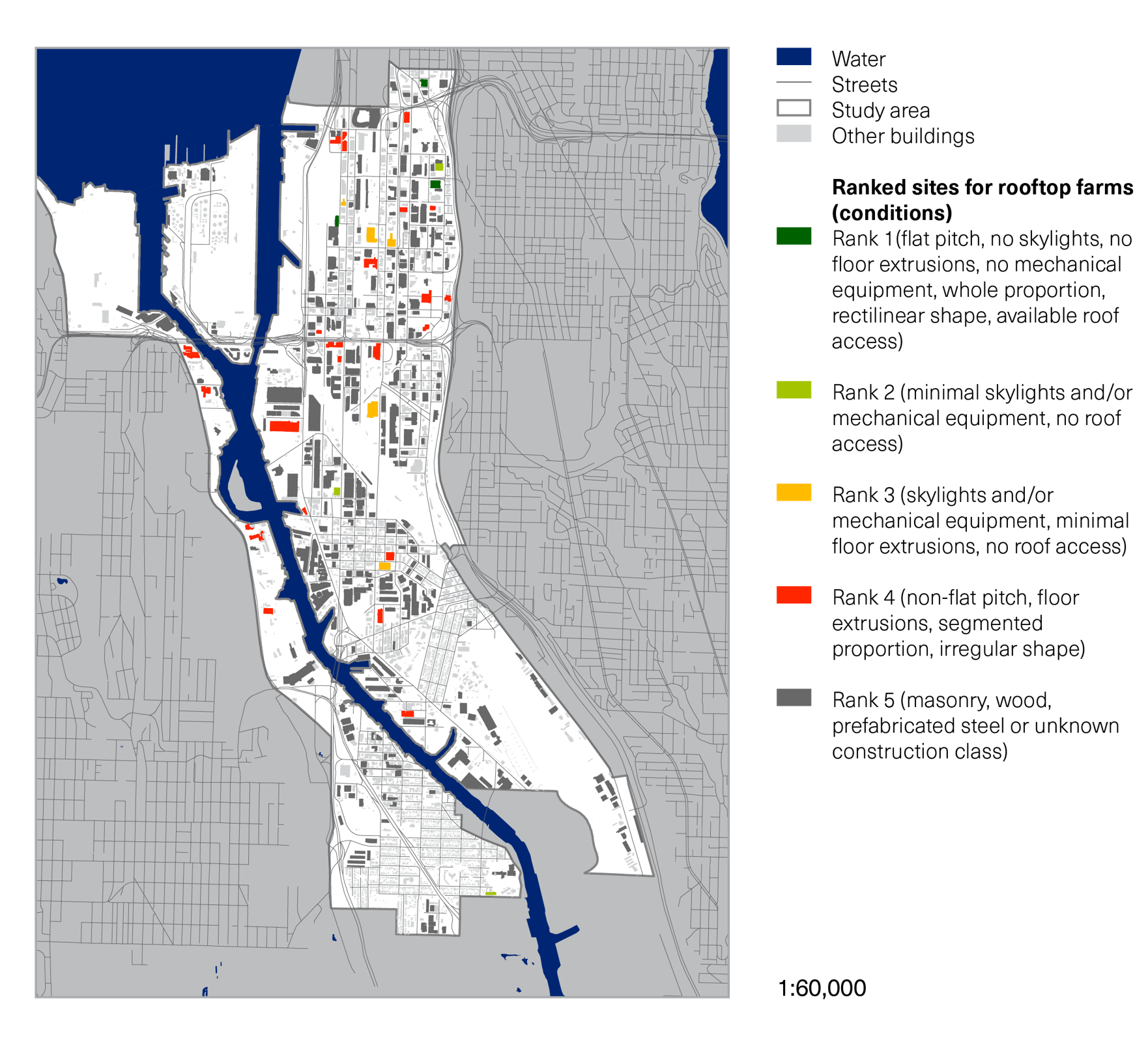

One phase of the project included developing a methodology for identifying buildings compatible with rooftop greenhouse farming in Seattle. I developed a building parcel selection strategy, and using open-source parcel data for Seattle as well as ArcGIS, generated the maps above, which look at physical constraints (left) and economics (right).